Guide to Mobile Mapping Solutions

Mobile mapping technology simplifies surveying and mapping processes. They provide convenient and practical solutions like real-time data collection, processing, and analysis. The technology is more accurate than the traditional systems. Plus, they save time and money. This guide will discuss mobile mapping and its application in surveying. We'll also discuss the key features, processes, techniques, and considerations when investing in mobile mapping solutions.
What Is Mobile Mapping in Surveying?
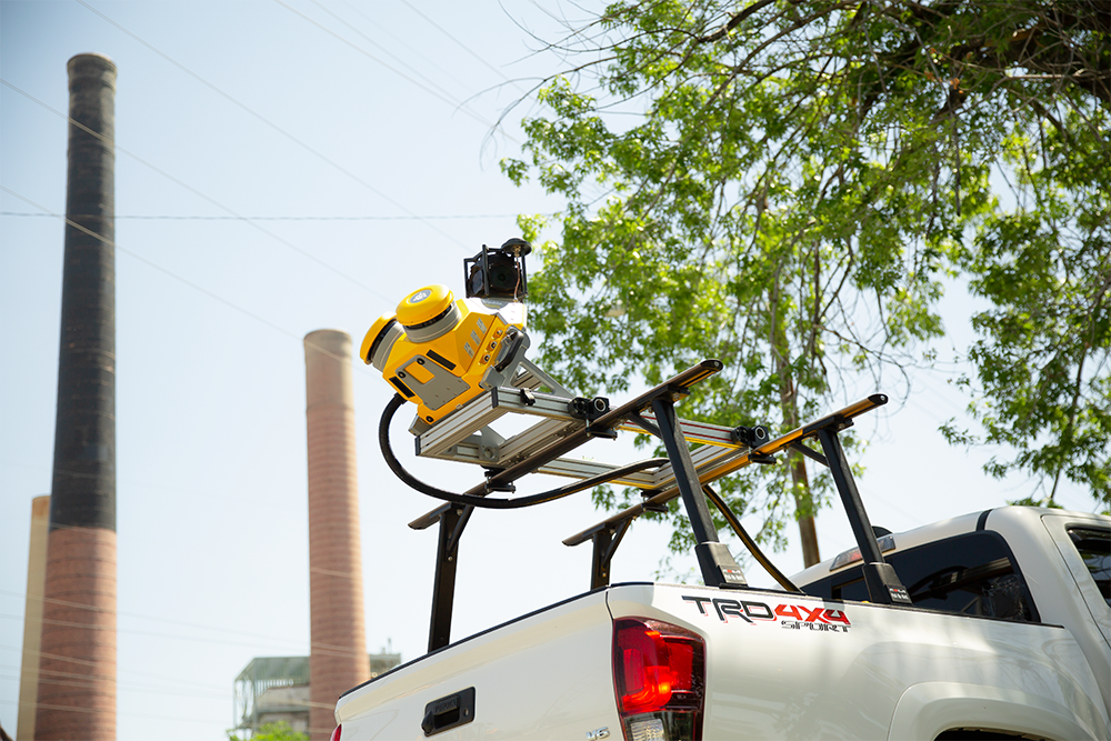
Mobile mapping is the process of collecting spatial data using mobile devices or platforms equipped with sensors like global positioning systems (GPS), LiDAR, cameras, and accelerometers. These devices could be mounted on vehicles like cars or drones. Some are also wearable on the body. The hardware captures data while in motion.
Mobile mapping technology allows for the rapid and efficient collection of geospatial information along construction sites, transportation routes, and urban areas. It provides detailed and accurate spatial data that you can use for the following:
- Creating maps
- Updating geographic information systems (GIS)
- Monitoring infrastructure
- Planning urban development
- Conducting asset management
Mobile mapping systems can capture a wide range of data, including 3D point clouds, images, videos, and other sensor data. The data collection could be processed and analyzed to create detailed models, maps, and visualizations to assist in mapping and surveying tasks.
The Evolution of Mobile Surveying
Mobile mapping technology started in the late 1980s to improve highway infrastructure mapping. The traditional systems were time-consuming and produced poor-quality images. Some outcomes were inaccurate, plus the process was expensive. Mobile mapping technology closed these gaps, allowing surveyors and engineers to leverage integrated features that simplify image capturing and error-free processing.
Mobile mapping systems are portable. They have high-efficiency cameras that produce quality images and easy-to-use 3D data sets. The systems also use software solutions to deliver accurate point clouds, direct georeferencing, live on-field feedback, and clear, noise-free results.
Today, businesses utilize the technology to provide accurate and reliable information. This information enables cost-effective, futuristic planning of transport systems, towns, and so on. Mobile mapping is fast, precise, and effective. It offers comprehensive environmental solutions that let you visualize, measure, and analyze features, objects, and landscapes.
Applications of Mobile Mapping Technology
Mobile mapping technology has a wide range of applications across various industries:
- Urban planning and construction management: City planners use mobile planning to survey and map urban areas, assess infrastructure needs, monitor growth, and plan future development.
- Field data collection: Mobile mapping enables field workers to collect data and surveys and capture geographic information in real-time.
- Asset management and inventory: Businesses use mobile mapping to track and manage assets, including inventory and equipment.
- Disaster response management: Mobile mapping is used to assess damage, coordinate rescue efforts, and plan evacuation routes during emergencies.
- Environmental monitoring: Mobile mapping helps monitor and manage natural resources, track changes in landscapes, and study ecosystems.
Key Features of Mobile Mapping Technology
Mobile mapping technology has evolved significantly over the years, offering many features. Here are a few examples:
1. Real-Time Data Collection and Management

Mobile mapping solutions are equipped with GPS receivers and sensors to capture location, orientation, and motion data in real-time. This data is sent to a centralized server or cloud platform using wireless networks, ensuring it’s available for immediate processing and analysis. You can utilize the data to extract meaningful insights, detect patterns, and generate actionable information.
2. Advanced Software and Cloud Solutions
Mobile mapping technology utilizes advanced software to capture, edit, and analyze geographic data. Some apps have real-time location tracking, route planning, and turn-by-turn navigation. The data collected is stored on secured cloud servers, which you can access anywhere. This feature enables collaboration and data sharing, especially if you’re working with people in various destinations.
3. Seamless System Integration
Mobile mapping technology integrates with various tools, applications, and data sources. This allows access to geospatial information from multiple platforms, enabling users to leverage the power of mapping technologies. For example, you can embed interactive maps, geocoding, routing, and spatial data visualization into mobile applications.
Some mobile mapping systems integrate with augmented reality (AR) technology to enhance user experience. You can overlay digital information on the physical environment, providing interactive and immersive navigation experiences.
Mobile Mapping Processes and Techniques
Mobile mapping involves various processes and techniques, such as:
- GPS data collection: Mobile mapping devices use GPS technology to determine location and collect data for georeferences and positioning in mobile mapping applications.
- Geographic information system (GIS) data collection: Mobile mapping devices capture GIS data, such as points, lines, and polygons, using GPS-enabled mobile devices. The data is stored in geodatabase and used for spatial analysis.
- Photogrammetry: Mobile mapping systems use photogrammetry techniques to create 3D models of objects or terrains from captured images.
- Light detection and ranging (LiDAR) scanning: LiDAR technology mounted on mobile platforms can capture high-resolution 3D point cloud data of the surrounding environment. The data is helpful for applications like infrastructure management and urban planning.
- Indoor mapping: Mobile mapping can create floor plans, navigation routes, and other indoor location-based services.
- AR mapping: Mobile mapping applications can use AR techniques to overlay geospatial data on live camera feeds for visualization, navigation, and exploration.
- Crowdsourced mapping: Crowdsourced mapping collects data from geospatial data from a large number of users through mobile devices.
- Real-time data streaming: Mobile mapping processes transmit location-based information, sensor data, and other geospatial data in real-time to central servers or cloud platforms for immediate processing and analysis.
Considerations When Investing in Mobile Mapping Technology
Here are four considerations for investing in mobile mapping surveying solutions:
- Business needs: Assess the demands of your business before buying a mobile mapping device. The type of operations you conduct will determine the equipment or software you need.
- Frequency of use: Is the device integral to your daily operations, or do you need it for a one-time project? Determining the frequency of usage will help you decide whether to buy or rent the equipment.
- Cost and ROI: Consider the total cost of ownership, including initial investment, maintenance, and training costs. Assess the potential return on investment (ROI) the mobile mapping system can provide regarding improved efficiency, productivity, and decision-making.
- Integration capabilities: Consider how easily the mobile mapping technology can integrate with existing GIS systems, mapping platforms, and other software solutions within your business for seamless data sharing and analysis.
Choose the Right Mobile Mapping Solutions With Duncan-Parnell

Choose a mobile mapping technology that suits your business needs — just remember that the purpose determines the type of equipment and software to acquire. If you need help finding the ideal solution, consult a professional at Duncan-Parnell for assistance.
Duncan-Parnell has over 75 years of experience providing surveyors, engineers, and other contractors with mapping and surveying solutions for every budget. We are the exclusive dealer for Trimble in the states we serve, with reliable hardware and software tailored to your needs. Our professional will help you find the best solutions, whether buying or renting.
Do you want to learn more about our offerings? Contact us today!