Engineering Firm Saves Time & Labor on Joint Use Inventory with TruPulse Rangefinding Technology
Based in Richmond, VA, Timmons Group is an engineering and technology firm that specializes in GIS, civil, environmental and surveying services across the United States. One type of project Timmons Group regularly performs is joint use inventories.
In 2019, Timmons Group was tasked with conducting a joint use inventory for all electrical/telephone poles that are shared between two major corporations. As part of the inventory, they would have to collect precise attributional, locational and vertical measurement data.
The Problem: Capture Precise Measurement Data for State-Wide Joint Use Inventory Without Using Hot Sticks
The challenge? Collecting accurate data while maintaining efficiency. Each pole housed a variety of equipment, and Timmons Group had to inventory not only the locations of the poles, but also the total heights and attachment heights for the various pieces of equipment, as well as the different cables on each pole.
Timmons Group Project Manager, Dylan Sheets, knew this project would require specific equipment that could not only handle these challenges, but also work in the sometimes-difficult environments they would inevitably run into. To find what they needed, Dylan turned to Duncan-Parnell and Technical Sales Representative, Russell Vrhovac, knowing their consultative approach would uncover the tools that would help boost his team’s efficiency and accuracy.
The Solution: Combine Sub-Meter Accuracy of Trimble R1 With Vertical Accuracy of TruPulse 200x Laser Rangefinder
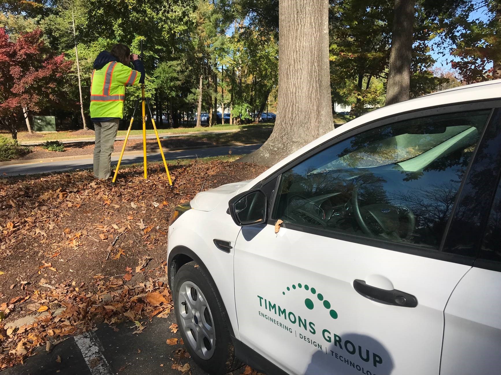
As a long-time Duncan-Parnell customer, Dylan and the Timmons Group team were familiar with their services and products and knew they’d have what was needed for this job. For this project, the team planned on using the Trimble R1 Bluetooth GNSS Receiver, which they already had experience with. The R1 would capture the sub-meter horizontal accuracy on each pole location, but they still needed something to capture high-accuracy vertical measurements.
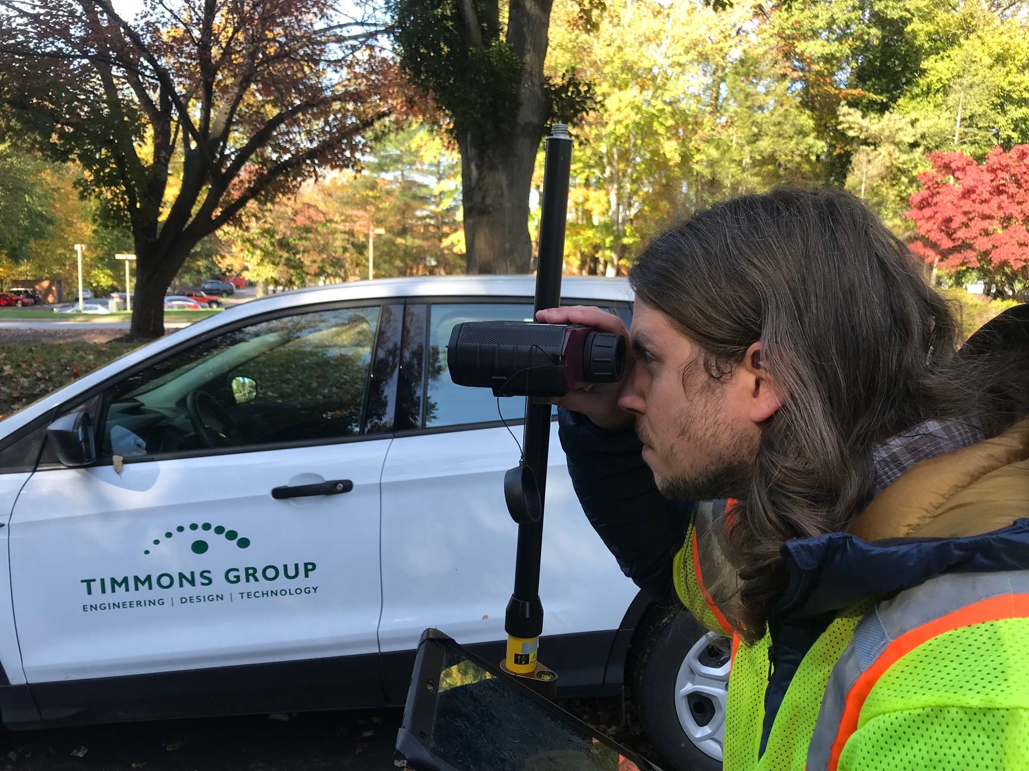
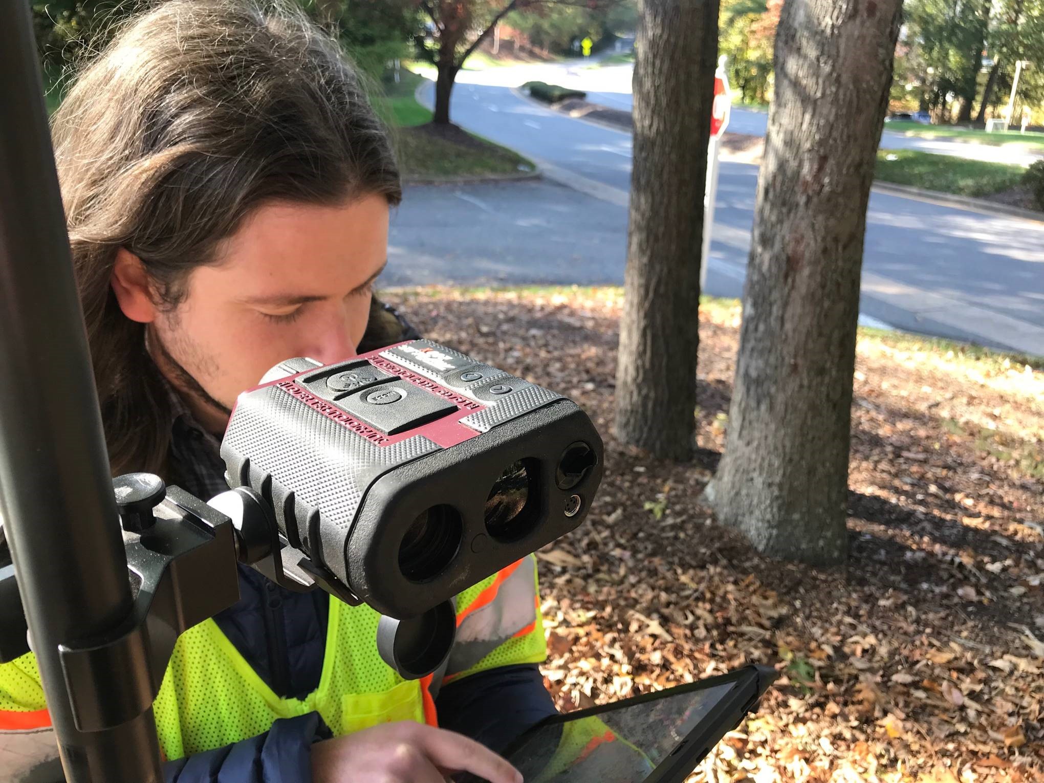
For the amount of measuring that this project would entail, Dylan knew he didn’t want to resort to using “hot sticks” – a time-consuming and labor-intensive method where the field teams need to have equipment in close proximity to live power lines to collect the necessary information. Between his research and Duncan-Parnell’s recommendations, Dylan was guided towards Laser Tech Inc’s TruPulse Rangefinding technology as a solution to this problem, because it would allow them to remotely measure height and connection points of various features on each pole.
The TruPulse 200x Laser Rangefinder would efficiently capture the complex, high-accuracy vertical measurements they had to collect. The small size of the rangefinder and its ability to harvest information entered into Esri’s ArcGIS Collector made it a great option for this project. This was the first time Dylan had worked with Laser Tech’s TruPulse technology, but since the equipment was so intuitive, it was easy to get acclimated, “Process of measuring multiple attachments on a pole is made much quicker and easier with [TruPulse] as opposed to using a hot stick for each measurement,” said Dylan.
Even though Dylan and his team were using the R1 prior to this project, Dylan reports the learning curve for it to be very small as well, saying, “if you can work a Bluetooth speaker you can work with the R1.” Additionally, to make the TruPulse even more user-friendly in the field, they mounted the rangefinder to a survey tripod, allowing them to conduct height surveys along with the positional surveys they were doing.
The Result: More Efficient Workflow & Confidence in Data
Although this is somewhat of a typical project for Timmons Group, the last time they took inventory of these poles was about 20 years ago. Back then, the joint use inventory didn’t involve measurements, so having the TruPulse 200x and R1 were critical in collecting the more in-depth data they needed this time around.
Today, the project is still ongoing, and Dylan is confident that these tools have saved him and his team significant time, “the entire team has felt the impact of working with these tools,” he said. Since his team of around 10 to 20 people are measuring dozens of poles a day, using these tools saves a lot of time and is much safer than the hot stick method.
After so many years of working with Duncan-Parnell, Dylan has been impressed with the effect the TruPulse Laser Rangefinders have had in combination with the R1, calling them “huge confidence boosters” for this project. Although the small learning curve allowed Dylan and his team to quickly implement the TruPulse 200x, he still relies on Russell whenever questions do arise, “Duncan-Parnell has been really awesome to work with and super responsive,” he said.
Interested in how TruPulse Laser Rangefinders can help with your next project? Contact our team to learn more!
-
 GIS & Mapping Webinar Series: Asset Tools & Innovations
On-Demand Webinars
GIS & Mapping Webinar Series: Asset Tools & Innovations
On-Demand Webinars -
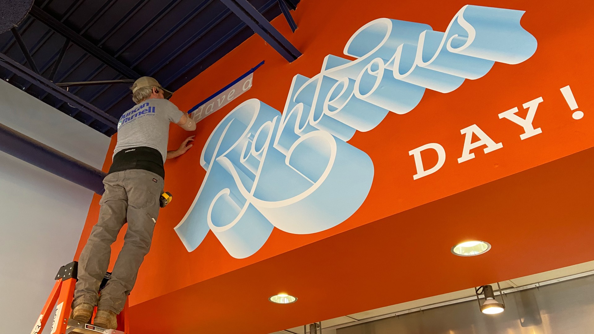 Building Brands Through Creative Signage
For nearly a decade, Duncan-Parnell has worked with The Splinter Group to help them bring their client's brands to life through creative signs and graphics.
Building Brands Through Creative Signage
For nearly a decade, Duncan-Parnell has worked with The Splinter Group to help them bring their client's brands to life through creative signs and graphics. -
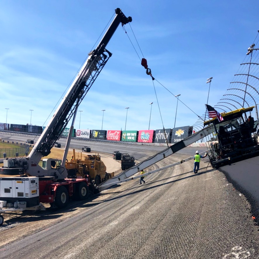 Atlanta Motor Speedway Gets a (Controversial) Fresh Repave with the Help of Trimble Tech
Customer Success Story
Atlanta Motor Speedway Gets a (Controversial) Fresh Repave with the Help of Trimble Tech
Customer Success Story -
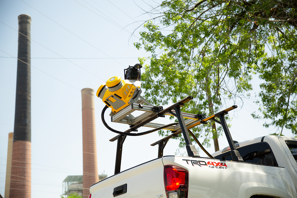 Beyond the Highway: How All Asset Managers Can Reap the Benefits of Mobile Mapping