A Guide To Using Drones and LiDAR Technology for GIS Mapping
Drones have changed the world, impacting people's everyday lives and industry alike. As technology continues to advance at a rapid pace, an increasing number of use cases are arising. When it comes to collecting GIS data for surveying and mapping, drones with built-in LiDAR technology are game-changers.
In this article, we outline what LiDAR technology is, how LiDAR drones work, and their use cases and advantages. We also discuss the key considerations to take into account when choosing a LiDAR drone for GIS mapping.
Using Drones and LiDAR Technology in GIS
Any drone that has a LiDAR sensor is known as a LiDAR drone. They collect GIS data that can be translated into some of the most high-resolution and accurate 3D models for use across a wide range of industries. LiDAR is an advanced technology that, up until very recently, has been reserved for specialized, high-budget projects.
What Is LiDAR?
LiDAR stands for Light Detection and Ranging. The technology uses sensors to shoot laser beams down to the ground. The laser bounces back, and the distance between the laser and the sensor is automatically measured and recorded. It creates ultra-detailed 3D maps and models of buildings, landscapes and practically any object you can imagine.
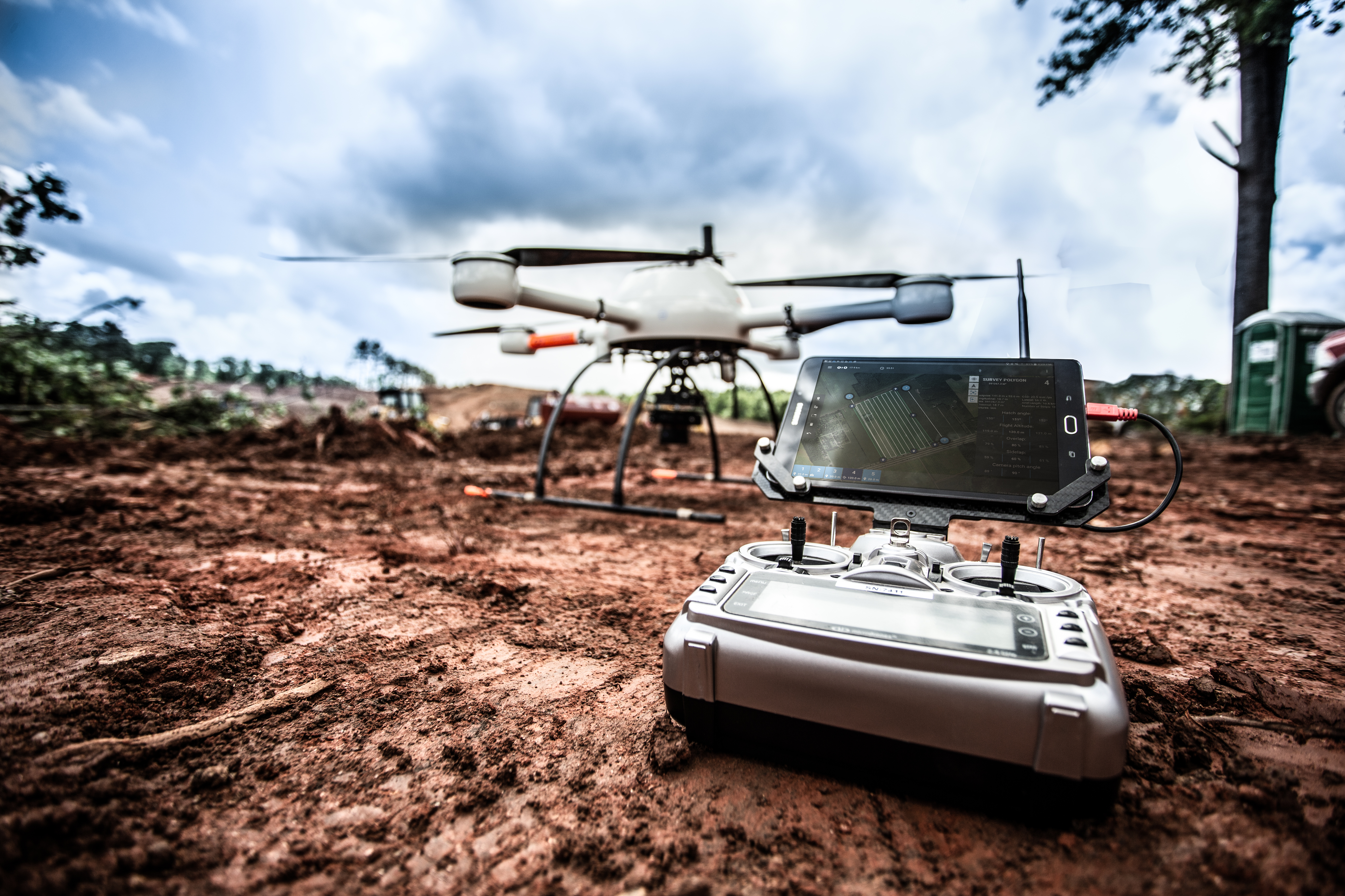
How Does LiDAR Drone Technology Work?
LiDAR sensors are smaller and more affordable than ever, making this super-accurate technology accessible to practically anyone. UAVs are fast becoming the industry standard in GIS mapping. They allow surveyors to monitor, highlight and analyze previously inaccessible grounds, such as areas with wind turbines and electrical towers. They can provide accurate measurements to create aerial imagery in areas prone to flooding, improving emergency planning processes and risk assessments. Likewise, they can assess regions where drought is common, using vegetation density technology to improve drainage systems.
How To Perform a LiDAR Drone Survey
Using a LiDAR drone is surprisingly easy, fast and affordable — especially in comparison to aerial vehicles such as planes and helicopters. Depending on the size of the survey area, you might use one or more UAVs to capture drone images. The data is fed to a GIS mapping software system, with the LiDAR technology producing laser-sharp, high-quality images.
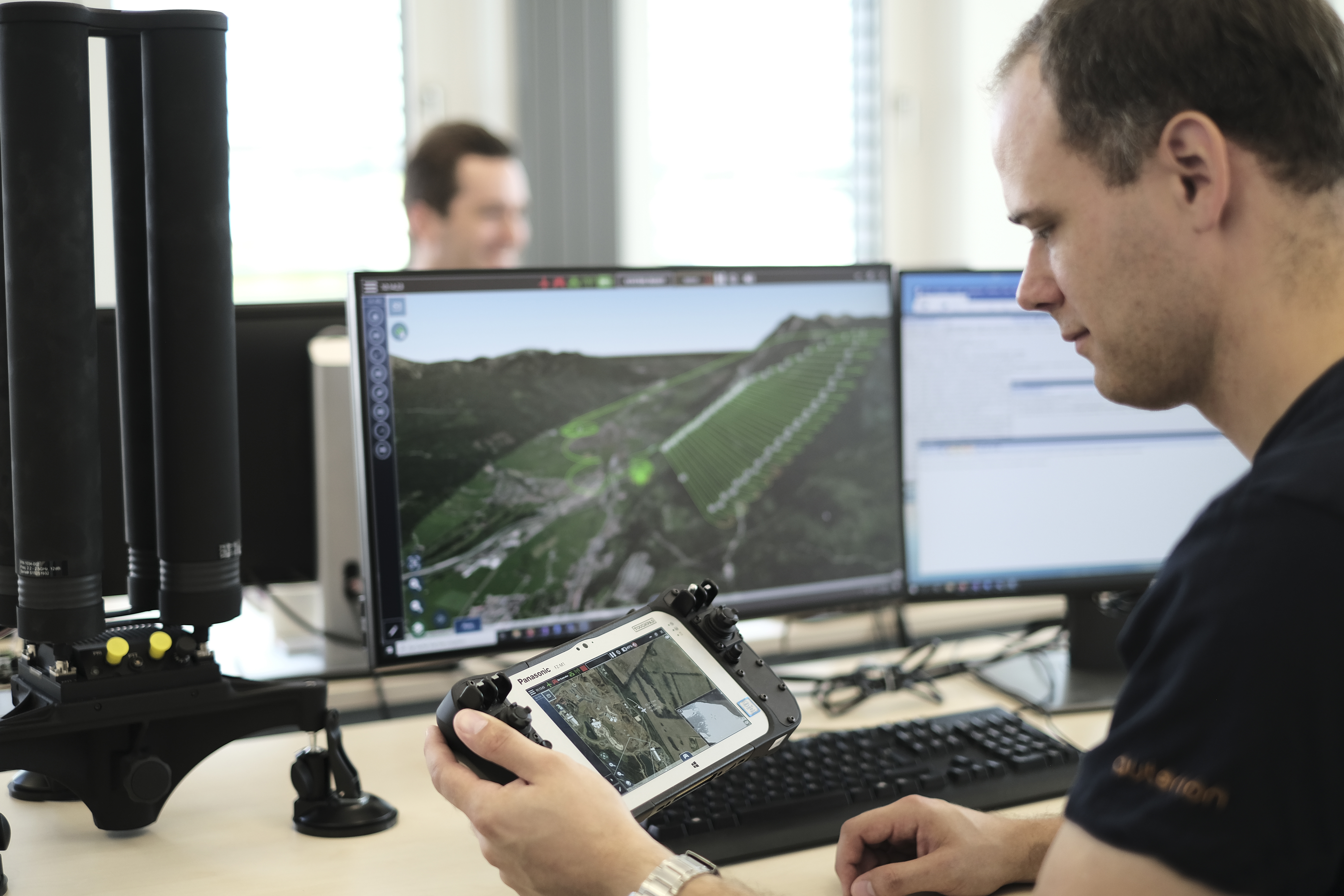
GIS Data for Aerial Mapping
After the LiDAR drone gathers data, it's transferred to a GIS platform to create 3D elevation models. You can even manipulate these models, build on them and use them for planning. GIS data is permanent, but what you get directly from the drone is raw and unprocessed. You'll also need 3D mapping software to extract, read and manipulate the data gathered by the drone.
LiDAR Drone Use Case Examples
LiDAR drones are revolutionizing every industry that relies on generating 3D maps. Below are some examples of areas where the technology is making waves.
Archeology
LiDAR drones can uncover discoveries in overgrown, hidden and partially buried sites at speed without impacting the ground. They facilitate no-dig surveys, eliminating the risk of disturbing the landscape or any man-made machinery beneath the surface.
Industrial Inspections
LiDAR technology allows inspectors to quickly create detailed 3D models of any space. When it comes to safety, this is a huge step forward because it eliminates the need to work at height or in confined spaces. What's more, drones can reduce downtime and speed up the industrial inspection process, resulting in major cost reductions.
Agriculture
Using a LiDAR drone is the fastest way to scan and map a farm with unparalleled accuracy. Maps can depict sunlight and crop production levels and can inform important decisions such as how much fertilizer to use. They can also help with livestock management and irrigation while saving time and money conducting research.
Conservation
There are numerous uses for LiDAR technology and GIS mapping in conservation, from forrestry to water conservation to sand dune mapping. Drones can produce high-quality 3D maps to help governments forecast, prepare and save money by making more accurate predictions.
The industries listed above are just a few that can put small, unmanned aircraft system mapping to good use. Land surveying, slope monitoring and urban planning are other examples.
Construction
Construction of large projects like highways as well as general construction site monitoring can benefit from the ability to easily conduct topographic mapping and land surveys with the use of drones.
Advantages of Using Commercial Drones for Mapping
In summary, the three core advantages of using drones for GIS mapping and surveying are:
High-fidelity, accurate data:
With drones, you can capture high-quality elevation data that facilitates ultra-precise mapping. Because LiDAR technology uses lasers and drones can gather countless measurements, it's the best way to capture real-time 3D images. Plus, each pixel of the resulting map is tagged with geodata.
Access to challenging or inaccessible areas:
Aerial mapping has, up until now, been limited to regions where planes or helicopters can fly. With a drone that can reach practically any area, traverse wild terrain and scale steep slopes, you can gather data safely and accurately.
Reduce time and money spent on project planning and execution:
Land-based and aerial mapping methods from yesteryear were extremely expensive and required extensive labor. Drones are faster and cheaper than traditional modes of mapping.
Types of Data
You can generate a range of different types of maps with a drone, including:
- Contour lines
- 3D textured mesh
- Digital terrain models
- Digital surface models
- 3D point cloud
- Orthomosaic
How To Choose a Drone for GIS Mapping
In addition to working out the rotor and wing configuration that's best-suited to your GIS Mapping project, you'll need to consider the nature of the project itself. Below is some guidance on how to select the best drone for your specific needs.
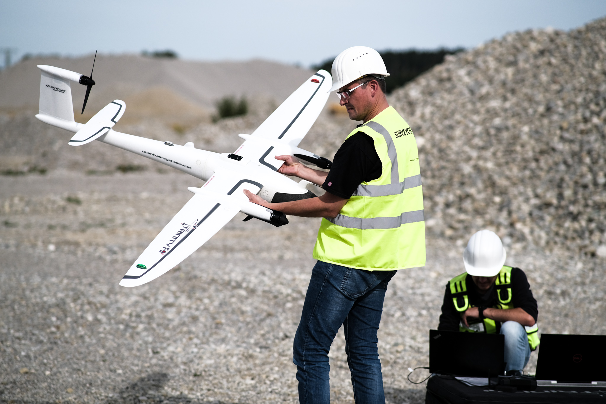
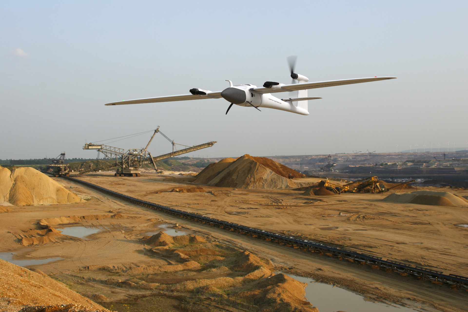
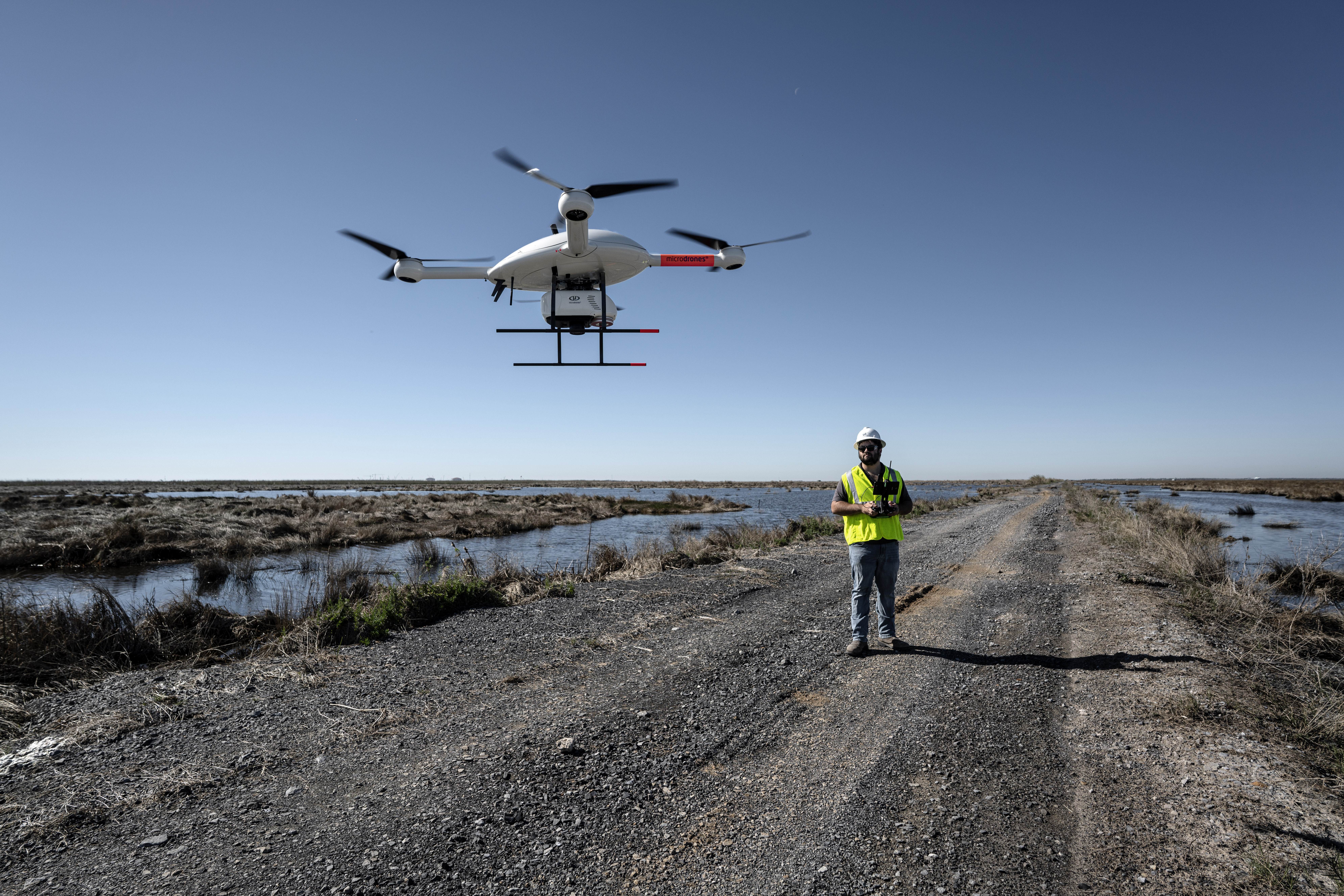
Fixed-Wing vs. Quadcopter One of the first considerations should be which type of LiDAR drone you require. Quadcopter and fixed-wing are the two most common. Fixed-wing drones are structured similarly to planes, making them easy to fly straight but more of a challenge to steer. They also glide as opposed to hover.
Quadcopters are a type of multi-rotor drone that are more blocky and a little more challenging to fly, but they also hover and are somewhat easier to steer. Base your choice on the nature of your project. If your aim is to cover a large area at speed, fixed-wing is likely more suitable. On the other hand, if you need to enter a smaller space or steer around obstacles, a quadcopter model would be better.
Increase Accuracy While Saving Time and Money
Quantum-Systems drones are highly automated and easy to operate, delivering high-res data far beyond the capabilities of satellites. Check out Duncan-Parnell's full range of LiDAR-based drones to find the best UAV for your project.