Ten Tips and Tricks when using GNSS Receivers
Ten Tips and Tricks when using GNSS Receivers
Practice Patience.
If your GNSS receiver has gone unused for a week or more, it can take up to 15 minutes to establish a connection and download a new almanac. Be patient while this download occurs and expect that you will see the correct accuracies once the download has completed. You will not be notified that the download is complete, so it is best to wait up to 15 minutes.
When using a non-pole mounted receiver such as the Trimble R1, Geo7x, or TDC150, keep in mind that your body can prevent the receiver from seeing over half of the sky. It is best to hold your receiver away from your body and face towards the southern sky whenever possible.
There is no need to know all the
math between HAE and Orthometric heights for elevation, but a basic
understanding will save some major headaches back in the office. Height Above
Ellipsoid (HAE) is an elevation based on a global model of the Earth’s surface.
GPS natively provides HAE elevations. The problem with HAE is that the model
used is far too general and does not provide accurate local elevations. We can
apply a GEOID correction to that HAE to get a more accurate elevation based on
a local model. This value is an Orthometric Height or Height Above Mean Sea
Level (MSL). Your sales rep or support team will be happy to assist in
confirming you are applying the correct GEOID correction.
Pay attention to datums and coordinate systems.
GPS is natively broadcast in WGS 1984. 90% of GIS data is in a coordinate system with a local datum. Pay attention to the coordinate system of the data being collected and that of the target data. When correcting the data, whether a local real-time service or post-processed, it will be corrected against a coordinate system with a local datum. Generally, this will match your GIS and no issues should arise. However, it is wise to keep an eye on the different coordinate systems and datums being used.
Bluetooth receivers only broadcast about 30 feet.
Plan Ahead!
Regardless of what field software
you are using, it is best to plan ahead. The beauty of field GIS is that we
have a lot of attributes that we can populate, take pictures and move quickly.
However, without proper planning those items may be left in the field.
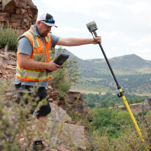
Hold your receiver level when collecting a point.
Whether you are using a pole mounted receiver or an all-in-one handheld, make sure that you are holding the receiver nice and level. Make sure you are using the bubble when using a range pole. Being just slightly off level can introduce error in your field data collection. The more accurate your receiver is, the more important it is to be level.
Set the proper pole height when collecting elevation data.
The standard pole that Duncan-Parnell sells is 2 meters, but yours may be different. In the settings of your data collection software, make sure you are setting the correct pole height. Also, keep an eye on units if your pole height needs to be imperial the conversion is 2 meters = 6.562 feet.
Take advantage of NGS Monuments.
NGS Monuments are plentiful and very useful. These survey monuments are great tools to verify the accuracy of your receivers - and they can be fun to find!You can find the monument nearest to you here: https://www.ngs.noaa.gov/datasheets/index.shtml