Jobie Hill: Saving Slave Houses
 In 2014, Jobie Hill needed mapping software for her Trimble GeoExplorer, so she turned to Duncan-Parnell. Her ambitious project captured our imagination, and we’re now fortunate to be a small part of it through the donation of Trimble TerraSync and Pathfinder Office software. The following is based on an interview with Jobie.
D-P: Tell us about your project and what made you want to pursue it?
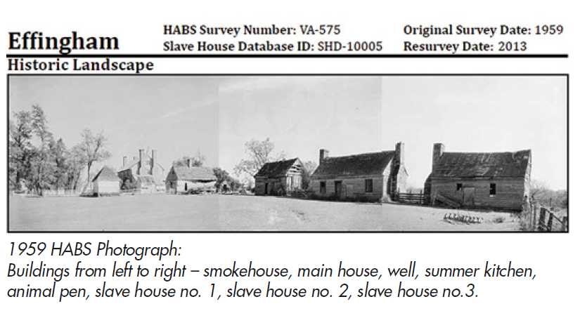
JH: The idea for this project came about when I was doing research for my Masters of Science thesis in Historic Preservation, entitled “Humanizing HABS: Rethinking the Historic American Buildings Survey's Role in Interpreting Antebellum Slave Houses”. I found that the slave house is not a building type that is consistently categorized or flagged in databases and other various collections. This lack of a systematically compiled database of domestic slave buildings makes comparative studies difficult.
As an effort to remedy this problem I developed the “Slave House Database,” a central repository of information pertinent to all the known slave houses in the United States. I created the framework for the Slave House Database in 2012. The database includes geographic information; owner contact information; local, state and national historic listings; architectural information; completed surveys and documentation; archaeological excavations; census data; and genealogical references. The Slave House Database is a crosswalk for diverse fields (architecture, anthropology, archaeology, historic preservation, genealogy and folk culture) to access and reference. The publishable Slave House Database can be used to identify, locate, analyze and interpret slave houses, as well as connect to other existing resources.
HABS (Historic American Buildings Survey) has completed surveys at over 400 sites with a slave house. I am currently in the process of returning to these sites to resurvey the buildings and identify the changes over time. To date I have successfully resurveyed 195 buildings.
D-P: How has GPS helped you with this project? What are you using and is it meeting your expectations?
JH: Summers, 2012 and 2013, I was employed as an architect for HABS, part of the Heritage Documentation Programs division of the National Park Service, U. S. Department of the Interior. In September 2013, I conducted a pilot survey project using a Trimble GeoExplorer. One of the key features of the GeoExplorer and its software that significantly improved my surveying time and methods, was the ability to create and modify a Data Dictionary. Uploading a Data Dictionary with a list of architectural features specific to domestic slave architecture allowed me to simultaneously record field data and an accurate location for each structure.
I am currently using a GeoExplorer 2008 series with Trimble TerraSync Professional and Pathfinder Office software. The equipment and software is working fabulously! Without these tools I would not be able to complete comprehensive architectural survey on my own. Each time I am in the field I learn something new, which usually requires me to tweak my Data Dictionary a little bit. Having the ability to quickly and easily modify my survey form is amazing.
D-P: What have been your biggest challenges with regards to your project?
JH: Surveying a building alone requires tremendous organization and the use of specialized equipment. Having the proper equipment is crucial to the success of my project for two reasons. First, using specialized equipment allows me to survey a building quickly and efficiently. This, in turn, allows me to complete multiple surveys in one day. Second, the information collected with the specialized equipment meets the standards of other organizations (e.g. Historic American Buildings Survey, Colonial Williamsburg, Library of Congress) that I intend to share my data with.
D-P: What is your end goal for this project?
JH: I have three end goals: 1. to collect and digitized all of the existing documentation of slave houses; 2. survey all of the extant domestic slave buildings in the United States; 3. to match all of the slave narratives to a specific site.
D-P: At what point do you think you will be able to say, “It’s finished”?
JH: The Slave House Database is meant to be a publicly accessible database that people can contribute to, so in that sense it will hopefully never be finished. For me personally, I think I will be able to say “I’m finished” when I fulfill two goals. First is that the Database is fully functional and has a permanent sustainable home. Second, is when I have completed surveys of all the structures in the Database. To date I have successfully resurveyed 195 buildings.
D-P: When all is said & done, what do you want people to take away with them after they have read your report?
JH: Slave houses, like other historic buildings, are a gateway to the past. Encapsulated within each structure is evidence of associated events and the people who inhabited the space. Historically, attention has been focused on the enslaved that were praised and acknowledged by their slaveowners, possessed a skill that the slaveowner could capitalize on, were exceptionally educated, or were relentlessly rebellious. The work I am doing for the Slave House Database project is my way of drawing attention to the lives of the millions of nameless and voiceless peoples who were seen as nothing more than human chattel, but are in fact a vital part of American History.
D-P: If someone is interesting in learning more about your project how can they get in touch with you?
JH: I am in the process of creating a website. Currently if people want to contact me my email is: [email protected].
-
 What engineering firm, Seamon Whiteside, thinks about Duncan-Parnell's OSPS program
This short video explains the OSPS program and how it has helped this firm stay ahead of the curve.
What engineering firm, Seamon Whiteside, thinks about Duncan-Parnell's OSPS program
This short video explains the OSPS program and how it has helped this firm stay ahead of the curve. -
 Duncan-Parnell sponsors 2nd Habitat House build in Raleigh, NC
-
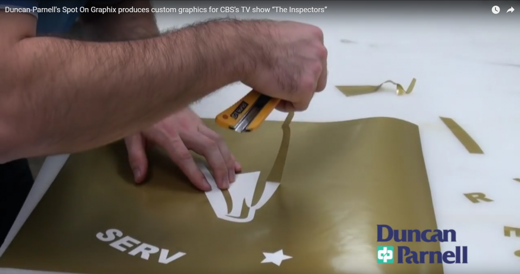 Duncan-Parnell produces custom graphics for CBS’s TV show “The Inspectors”
-
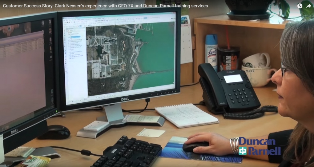 Clark Nexsen experience with GEO 7X and Duncan-Parnell training services
GIS Analyst Deborah Huber discusses how utilizing advanced technology from Trimble and Duncan-Parnell, Clark Nexsen realized a quicker return on investment.
Clark Nexsen experience with GEO 7X and Duncan-Parnell training services
GIS Analyst Deborah Huber discusses how utilizing advanced technology from Trimble and Duncan-Parnell, Clark Nexsen realized a quicker return on investment.